20 Best Sales Territory Design Software In 2024

10 Best Sales Territory Design Software Shortlist
Here's my pick of the 10 best software from the 20 tools reviewed.


With so many different sales territory design software available, figuring out which is right for you is tough. You know you want to ensure fair and strategic distribution of sales territories but need to figure out which tool is best. I've got you! In this post I'll help make your choice easy, sharing my personal experiences using dozens of different sales territory design tools with various teams and territories, with my picks of the best sales territory design software.
What Is Sales Territory Design Software?
Sales territory design software is a tool used by businesses to allocate and manage sales territories. It combines geographic mapping and data analysis to organize territories based on factors such as customer demographics, market potential, and geographic location. The software integrates sales and customer data to create optimized, balanced sales territories and provides tools for performance analysis and real-time updates.
The benefits of using sales territory design software include increased sales efficiency and balanced workload distribution among sales representatives. It aids in strategic planning, ensuring territories are aligned with market opportunities and organizational goals. This leads to improved sales performance by targeting high-potential areas and minimizing travel time and costs. The software also enables data-driven decision-making, providing insights for better territory management. Additionally, it offers flexibility to adapt territories in response to changes in the market or organizational structure, enhancing overall sales effectiveness.
Overviews Of The 10 Best Sales Territory Design Software
Ready to dive into these summaries of the top ten best sales territory design software options? As you explore each one, you’ll see that I’ve included a summary, as well as a list of the standout features and why they made my list. I also made sure to cover the pricing structure and a few pros and cons that could narrow down your selection.
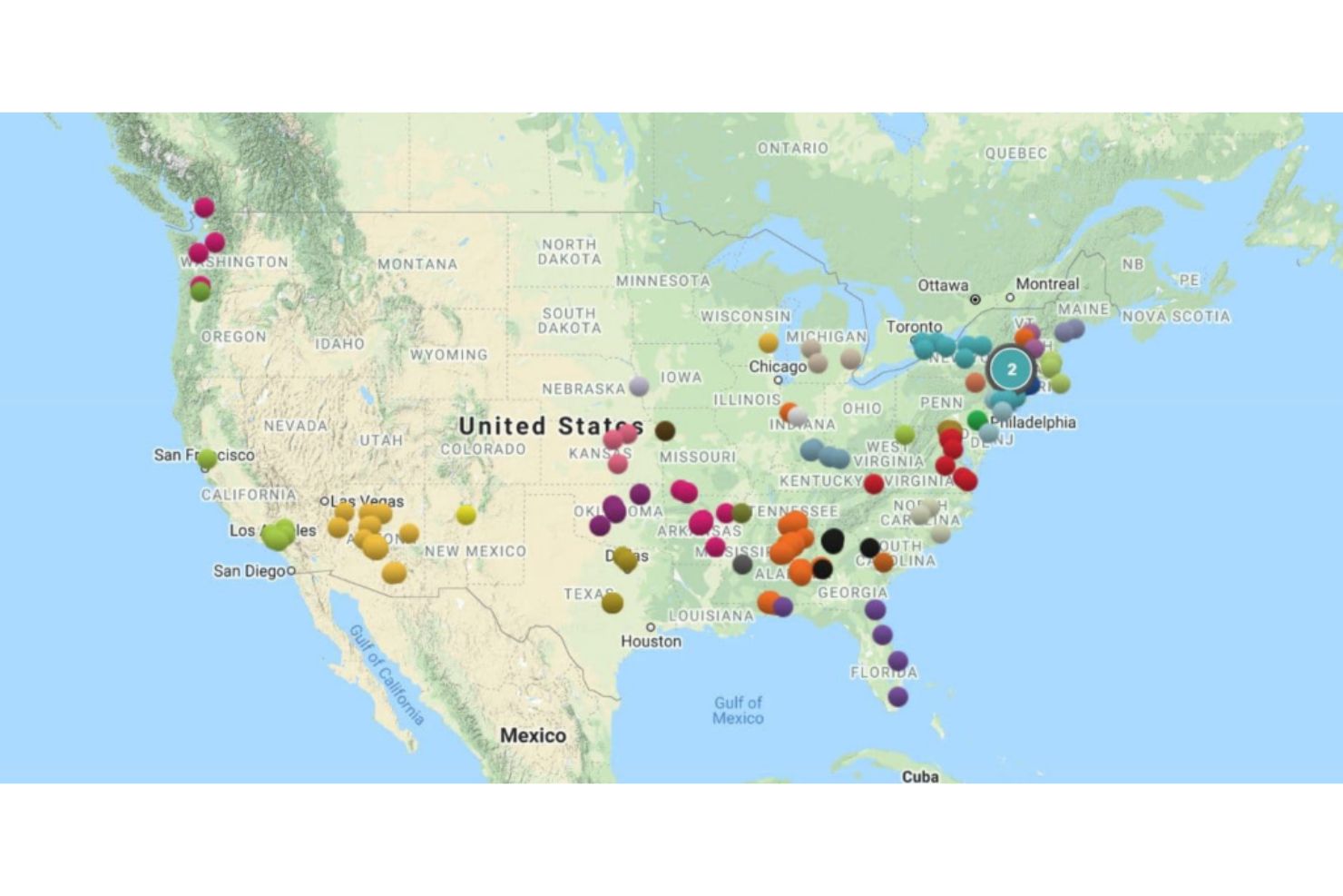
Maptive is a unique territory optimization tool that allows you to create insightful custom maps from your business’s geolocation data sets. With a series of mapping tools you can use to enhance your Google Maps foundation, you can experiment with sale density maps, heat maps, store locators, and territory maps that ensure you can optimize sales performance.
Why I picked Maptive: This tool caught my eye because it’s specifically designed to work with Google tools. You have Google Street View, Google Geographic Search, and Google Places Search, all available directly on the platform. You can leverage Google’s comprehensive information to get an on-the-ground understanding of any location.
Maptive Standout Features and Integrations
Standout features include turn-by-turn navigation in-app when you link it to your mobile device and custom markers and images that you can upload yourself.
Integrations include Google Maps. CRM integrations coming soon.
Pros and cons
Pros:
- Great customer service team
- Incredibly user friendly
- Very fast for geocoding addresses
Cons:
- Some loading delays can slow your workflow
- Pricing can be a little high

As a field sales management software, Badger Maps is designed to help businesses manage representative routes, explore new opportunities, collect new data, and follow up on previous visits. This territory mapping tool has a mobile app, as well as a built-in mapping tool that can help you create sales routes, estimate arrival times, and streamline every drive.
Why I picked Badger Maps: I added this tool to my list because it prioritizes route planning to help you cut down on prep and drive time. Badger Maps reports that salespeople who use this software drive as much as 20% less and spend only 10 minutes prepping per day.
Badger Maps Standout Features and Integrations
Standout features include customized data visualization set up for you by the Badger Maps specialists and personalized onboarding and training to speed up implementation and adoption.
Integrations include HubSpot, Insightly, Microsoft Dynamics, NetSuite, RESTAPI, Salesforce, Zapier, and Zoho CRM.
Pros and cons
Pros:
- Robust customer support team
- Super user-friendly interface
- Native mobile app for iPhones and Android
Cons:
- Requires internet connection to operate
- No free or affordable option for small businesses
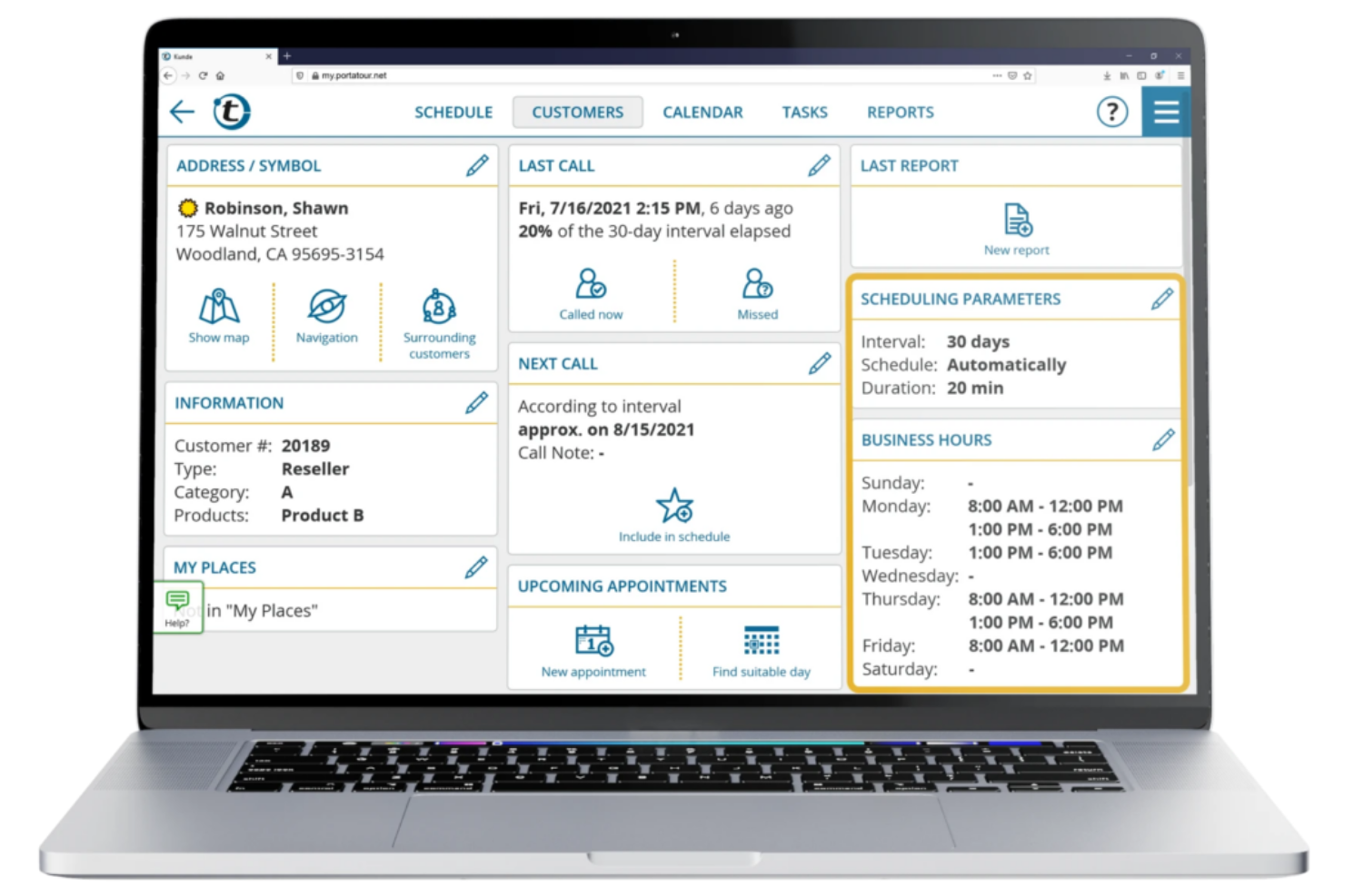
This cloud-based sales route planning software is made to help your sales team plan and optimize sales routes from home base or on the road. Use this tool to reduce mileage and emissions, increase sales rep productivity through automated scheduling suggestions based on previous customer interactions, and enjoy route calculations that take holidays, business hours, and customer preferences into account.
Why I picked Portatour: What made me add this platform to my list was the automatic route planner app. Once you’ve designed your territories and added in customer requests, you can use the Portatour app to automatically schedule routes in just a few seconds based on current conditions.
Portatour Standout Features and Integrations
Standout features include configurable customer assignments and restrictions and lead management to record and store customer data.
Integrations include Microsoft Dynamics, Microsoft Excel, Salesforce, and Veeva. Portatour also offers API data exchange PowerShell scripts for custom integrations.
Pros and cons
Pros:
- Easy to learn how to use
- Mobile accessibility for field teams
- Automation-first approach to speed up operations
Cons:
- Cost prohibitive for small businesses
- A little complicated to set up

As a GIS and mapping software, Maptitude strives to offer a cost-effective solution for optimizing your sales territories, site locations, and vehicle routes, as well as analyze, visualize, and present the most critical data about your profits, workflow, and resource allocation. Discover geographic patterns that make a big difference to your decision-making.
Why I picked Maptitude: This tool seems incredibly useful to me due to its spatial mapping feature. With this feature, you can estimate the population of any given area to design custom territories that identify and address over and under-served areas, determine ideal trade areas, and find valuable sites for physical stores based on the geography of the location.
Maptitude Standout Features and Integrations
Standout features include map creation using data from your choice of source, including Excel, SQL Server, or Access, and online sharing with maps embedded into your website.
Integrations include Access, Google Maps, Microsoft Access, Microsoft Excel, and TransCAD.
Pros and cons
Pros:
- Friendly and supportive customer service
- Affordable options for small businesses
- User-friendly design and navigation
Cons:
- Can be slow to upload large data sets
- Advanced features are a little complicated to learn

Since Yellowfin is primarily a Business Intelligence platform, it offers data exploration, dashboards, and self-service BI experience in addition to mapping and territory planning capabilities. With advanced visualization features, this solution offers you a no-coding interface that simplifies analytics to better support your sales operations.
Why I picked Yellowfin: Even though it’s a BI platform, this solution caught my eye because you do get location intelligence functionality that merges traditional and spatial business analytics to improve your decision-making. Use Yellowfin’s built-in mapping tools or Google Maps API to design maps based on demographic data, real-time business data, and other essential metrics.
Yellowfin Standout Features and Integrations
Standout features include native mobile apps that ensure analytics and mapping accessibility and guided NLQ to help you answer difficult questions about your sales process.
Integrations include Dynamics 365, GitHub, Google Analytics 360, Google Sheets, Instagram, Meta for Business, Salesforce Sales Cloud, Tableau, Xero, and Zendesk Suite.
Pros and cons
Pros:
- Has effective online training tools
- Specifically designed for self-service
- Simple interface for non-technical users
Cons:
- Online accessibility only, no cloud-based options
- Some customizations will require coding

This mapping and sales productivity tool focuses on targeting territory design and customer segmentation with in-house licensing, consulting licensing, and several add-on options. AlignMix prioritizes adoption and implementation with guided custom software configuration and onsite training for your team.
Why I picked AlignMix: What I like about this platform is how easy it makes editing and adjusting territory boundaries. You can create a map from scratch and edit it as needed until it perfectly fits your needs, or you can adjust older maps to reflect changes in territories and boundaries based on how your business has evolved. You can use territory labels to get immediate feedback on how your changes impact your organization.
AlignMix Standout Features and Integrations
Standout features include data import and export with any Excel spreadsheet, account or geography-based alignments, and a massive selection of demographic data sets based on zip codes.
Integrations include Adobe PDF, Excel, Google Maps, MyMaps, PowerPoint, and Tableau.
Pros and cons
Pros:
- Beautiful visualization template options
- User-friendly interface design
- Simple functionality for editing tools
Cons:
- Expensive for small businesses
- No monthly subscription options

A web-based platform from Ascent Cloud, Geopointe is designed to help you schedule routes and trips, redesign and align territory maps, and create unique marketing campaigns based on demographic data in a variety of geographic areas. This platform can also help your sales reps fill in meeting cancellations and log notes to keep your central hub up-to-date.
Why I picked Geopointe: This tool made my list because it offers several territory design-specific features for Salesforce data, including a Shapes Editor and Automated Assignments. The Shape Editor shows how territory adjustments impact business operations, while Automated Assignments distribute leads and territory assignments based on your rules to ensure fairness.
Geopointe Standout Features and Integrations
Standout features include route optimization and trip planning to save on drive time and resources, as well as geographic search and analysis for location-specific insights.
Integrations include Salesforce Sales Cloud and Territory Planner.
Pros and cons
Pros:
- Range of price points for any business size
- User-friendly interface design
- Knowledgeable customer support team
Cons:
- Navigation isn’t very intuitive
- May take up too much storage

Unlike some other solutions on my list, SmartDraw is more about designing and drawing diagrams than territory management. As a design tool, it can be incredibly useful for mapping with its alternative features, like wireframes, mockups, templates, diagrams, and pre-built charts. SmartDraw automates a lot of the design process to ensure you can add, move, and delete shapes more easily.
Why I picked SmartDraw: I like this tool because it provides a single-use solution to sales territory design. If you’re not looking for advanced features and in-depth analytics, SmartDraw is the tool for you. It offers simple, custom, automated map and territory design that addresses your unique needs.
SmartDraw Standout Features and Integrations
Standout features include editable map templates from every region and an intelligent formatting engine to automatically adjust shapes and positions.
Integrations include AWS, box, Confluence, Dropbox, Google, Jira, Microsoft Azure, Microsoft Teams, and Trello.
Pros and cons
Pros:
- Affordable pricing for all businesses
- Intuitive navigation
- Easy to learn
Cons:
- Templates have preloaded data that must be cleared
- Limited reporting and analytics

This web-based sales territory design software can help you transform static business data into something more dynamic and informative through unique visualizations and advanced mapping functionality. GeoMetrx strives to help you compare, map, and rank a variety of pre-set attributes that relate to your business operations and demographic data.
Why I picked GeoMetrx: A unique feature that stood out to me about this tool is the types of reports it provides. With its census-based reports, you can get Snapshots, Detail Summaries, Benchmark Comparison Summaries, and Trend Summary Reports based on your preferred location.
GeoMetrx Standout Features and Integrations
Standout features include personalized and branded reporting tools, as well as geographic filtering based on county, zip code, or metro.
Integrations include Google.
Pros and cons
Pros:
- Intuitive navigation and interface
- Simple, easy-to-learn features
- Free plan for solo users
Cons:
- Newer tool with features still under development
- Limited integration options

This cloud-based territory mapping software uses location technology to deliver geographic solutions to international organizations. eSpatial specializes in territory alignment, routing, data visualization, target marketing, prospecting, and gap analysis. Your team also gets dynamic visual insights at street, zip code, country, and coordinate levels.
Why I picked eSpatial: This tool made my list because of its territory management features. Whether you design geographic or account-based territories, eSpatial can warn you where there are pockets of underperforming areas, high employee turnover, areas that aren’t meeting expectations, and high mileage expenses.
eSpatial Standout Features and Integrations
Standout features include template creation for maps that display only what you want to see and radius maps that provide data points for relevant information to help with territory planning.
Integrations include Salesforce.
Pros and cons
Pros:
- Intuitive tools and navigation
- Very easy to use
- Appealing user interface
Cons:
- Adding multiple map elements is time-consuming
- Very expensive pricing at the lowest tier
| Tools | Price | |
|---|---|---|
| Maptive | From $250 for a 45-day pass | Website |
| Badger Maps | From $49 per user/month | Website |
| Portatour | From $89.95/user/month (billed quarterly) | Website |
| Maptitude | From $420/user/year | Website |
| Yellowfin | Pricing upon request | Website |
| AlignMix | In-house licensing is available for $1,500/user/year | Website |
| Geopointe | From $70/month | Website |
| SmartDraw | From $8.25/user/month (billed annually, min 3 seats) | Website |
| GeoMetrx | Pricing is available upon request | Website |
| eSpatial | From $1,495/user/year | Website |
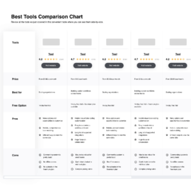
Compare Software Specs Side by Side
Use our comparison chart to review and evaluate software specs side-by-side.
Compare SoftwareOther Options
No list of mine could ever be complete without a few runners-up to the main list. Check out just a few more mapping solutions to round out my list here:


Selection Criteria For Sales Territory Design Software
Here’s a short summary of the main selection and evaluation criteria I used to develop my list of the best sales territory design software for this article:
Core Functionality
Sales territory design software should have a few core functionalities that drive its power for a variety of use cases, including:
- Establishing territories
- Storing client details
- Optimizing routes
- Managing customer locations
- Providing mobile access
Key Features
To ensure the software I chose could meet the core functionality defined above, you’ll see a variety of features for territory management and more. Some of the key features repeated again and again include:
- Territory design: This element of territory management is used to customize sales territories to quickly add, remove, or adjust boundaries according to your chosen criteria, including demographics, postcodes, and geography.
- Route optimization: Part of territory design and mapping is optimizing your routes to ensure the most efficiency for your field reps. You want to minimize travel time with appropriately clustered stops.
- Heat mapping: This tool shows you how people are interacting with your website or product by using color coding to display the intensity of specific interactions, like the number of page views or clicks.
- Performance analytics: This feature helps you gain insight into the performance of reps in each assigned territory, including metrics like travel time, revenue per region, number of customers per region, and completion rates.
- GIS: As I mentioned earlier, GIS stands for geographic information systems, which is a tool designed to provide spatial and geographic data that can help you customize maps with multiple layers.
- Native apps: Since you want your outside sales team, delivery drivers, and other field team members to have access on the go, prioritizing territory management software with a mobile app can ensure they’re connected through smartphones and tablets.
Usability
Since you want to ensure adoption is easy throughout your organization, I prioritized those territory design software options that have intuitive navigation, self-service learning tools, and self-explanatory features that make them simple to use. I also checked for responsive design and user-friendly interfaces.
Software Integrations
Sales design territory software has to have access to a ton of sales data to ensure accuracy — from customer location and contact details to scheduling availability and route information. I looked for tools with native integrations and listed the most popular options in each platform summary.
Pricing
Sales territory design software varies in capability and functionality, so pricing is pretty wide too. You’ll find a few tools that offer free access to limited features, as well as options priced as low as $3/user/month. However, most software pricing will range between $20/user/month and $75/user/month.
In some cases, for enterprise functionality or premium access, you’ll see prices as high as $200/user/month, along with a licensing or platform fee. There are also several options that only have yearly pricing of around $1,000/user.
People Also Ask
Looking for more information about sales territory design software? I have answers to all the most common questions here. Check them out!
Who uses sales territory design software?
There are a variety of use cases for sales territory design and mapping software, and many industries and roles can benefit from its use, including:
- Salespeople who need to plan out territories or daily routes to ensure more effective reach.
- Delivery drivers who want to find the most efficient routes possible to fulfill deliveries in a timely manner.
- Distributors that need to manage a large number of locations across a variety of geographies.
- Real estate agents who want to keep track of listings, prices in specific regions, and location-based metrics.
- Field service personnel who visit multiple locations during a short time span can use it to identify better routes and shortcuts.
What are the benefits of sales territory design software?
If you’re wondering why you should implement sales territory management into your operations, take a look at these key benefits:
- Increase efficiency: Automation and visualization tools allow your sales reps to more quickly and accurately identify prospects in a region and eliminate the need to search through lists to find answers.
- Better data management: With interactive and visual representations of important business metrics, your team can access information more easily, and your managers can make data-driven decisions.
- Improve resource allocation: Get the information you need to see how you’re utilizing your resources and optimize allocation depending on how profitable various territories are, what their market potential is, and how far away they are.
- Enhance customer service: Since your team can instantly view client locations in relation to rep territory, you can respond faster when customers require assistance. Send the closest person to address their needs more quickly.
How do you design a sales territory?
If you’re interested in designing a sales territory to optimize team performance and maximize revenue, take a look at this step-by-step guide to get you started:
- Assess your current operations to better understand your customer base, performance, market potential, and sales resources.
- Define your objectives and sales criteria to better align them to ensure geography, account size, and customer type fit into how you plan to increase sales or reduce costs.
- Use manual mapping or design software to create and test your sales territories based on your initial criteria and goals.
- Implement your design and monitor performance to measure the impact of your new territory design.
- Edit and modify territories and metrics as needed until you’re achieving your goals.
Other Sales Software
If you’re looking for a few other outside sales tools to enhance your tech stack, I have tons of recommendations, including:
- Sales Mapping Software
- Mobile Sales Software
- Field Sales Software
- Sales Engagement Software
- Strategic Planning Software
- Free Lead Management Software
What Now
With all this information, you should be well-positioned to choose the right territory design software to meet your needs. Whether you’ve already made a final decision or you want to start with a free trial, use my list to take action.
And don’t forget that The RevOps Team releases a weekly newsletter to provide you with unique insights into the newest trends every week. Sign up now to receive advice from the experts right to your inbox.